|
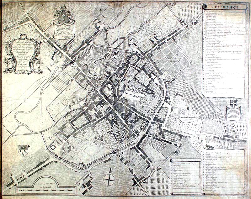
Return to maps page This page (below) has a map of Canterbury of 1752 - an engraving by William and Henry Doidge 'A plan of the Antient City of Canterbury together with the remains of St. Austin's Monastery carefully surveyed and delineated by W & H Doidge, Land Surveyors, April 1752. I'm only sorry I can't get a better scan showing more detail, but I'm still trying! |
|
 |
|
|
© Copyright Stephen Bax 1999-2002. Click here for terms of use. |
|