|
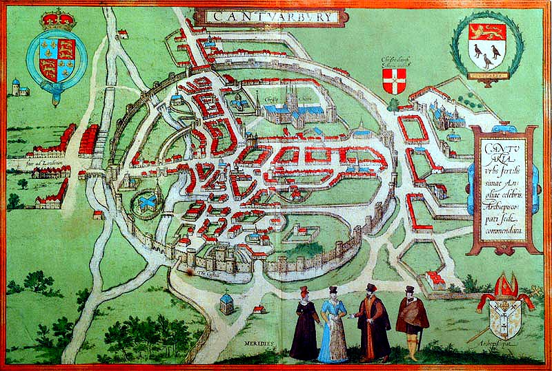
Return to maps page This page (below) has a map of Canterbury of around 1580 - a coloured engraving produced by George Braun and Frans Hogenberg - 'A Birdseye view of the City of Canterbury' - 11.5 inches by 17ins. |
|
 |
|
|
© Copyright Stephen Bax 1999-2002. Click here for terms of use. |
|